NOAA-Usibility Testing of Office of Response and Restoration's Website Mobile Design
Generic Clearance for the Collection of Qualitative Feedback on Agency Service Delivery
Usability Testing Office of Response.Script (external user tasks 1 and 2)
NOAA-Usibility Testing of Office of Response and Restoration's Website Mobile Design
OMB: 0690-0030
Usability Test Scripts for External Users
Contents
Task 1: Firefighter on a HAZMAT team has heard that there’s a new version of CAMEO’s mapping program.
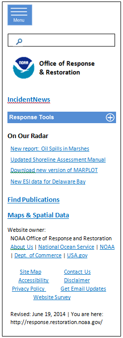
Mobile Homepage:
User clicks Menu:
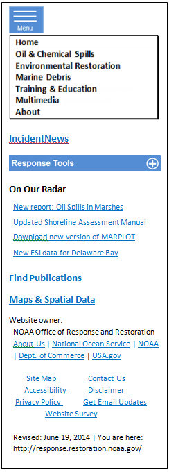
User clicks Oil & Chemical Spills (in Main Menu):
Oil and Chemical Spills
Every year NOAA responds to more than a hundred oil and chemical spills in U.S. waters, which threaten life, property, and public natural resources….
Oil Spills
During an oil spill in coastal waters, OR&R's role is to provide scientific support to the U.S. Coast Guard….In addition to spill response software and mapping tools….
Chemical Spills
Chemicals can be an important part of manufacturing valuable economic goods—but they can also create dangerous situations…
Significant Incidents
For significant spills, OR&R is responsible for providing scientific support to the Federal On-Scene Coordinator...
Disaster Response Center
The NOAA Gulf of Mexico Disaster Response Center (DRC) is the newest addition…
User clicks Chemical Spills:
Chemical Spills
Chemicals can be an important part of manufacturing valuable economic goods—but they can also create dangerous situations if accidentally released. OR&R develops several free tools, such as the CAMEO software suite, to help emergency responders and planners assess hazardous material releases and protect public health and safety.
Response Tools
Some of OR&R's more widely distributed chemical spill response tools include the CAMEO software suite (CAMEOfm, CAMEO Chemicals, ALOHA, and MARPLOT), a group of programs used by first responders and planners to help them prepare for and deal with hazmat emergencies. In addition, responders and planners can use the Chemical Reactivity Worksheet, a program that allows you to see what reactions might occur when pairs of chemicals are mixed together.
Resources
Emergency responders (as well as programmers developing tools for use with the CAMEO software suite) can find an assortment of helpful guides, software tools, and training information …
User drops down Response Tools menu

User clicks CAMEO Software Suite:
CAMEO Software Suite
The CAMEO (Computer-Aided Management of Emergency Operations) software products have been valuable hazardous materials response and planning tools since the first products were introduced in 1986....
CAMEO Software Suite: Core Programs
CAMEOfm: A database application ….to assist with data management requirements under the Emergency Planning and Community Right-to-Know Act (EPCRA)....
CAMEO Chemicals: A program that allows you to search for chemicals in the CAMEO chemical database, print customized reports with response recommendations, and find out how chemicals would react if they mixed….
ALOHA: A modeling application that estimates threat zones associated with hazardous chemical releases, including toxic gas clouds, fires, and explosions.
MARPLOT:
A mapping program with which you can easily view and modify maps, and
you can also create your own objects.
CAMEO Software Suite: Related Software
The Chemical Reactivity Worksheet: A program that allows you to see what reactions might occur when pairs of chemicals are mixed together...
Tier2 Submit: A program that generates an electronic chemical inventory Tier II facility report, which can be used to automatically update the facility information in CAMEOfm...
User clicks MARPLOT:
MARPLOT
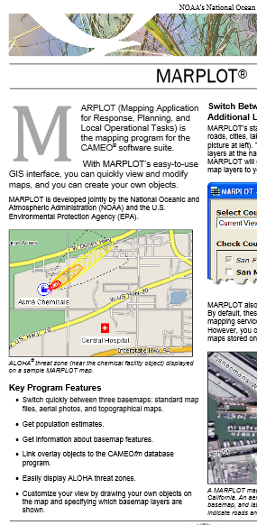
MARPLOT is a mapping program. With MARPLOT's easy-to-use GIS interface, you can quickly view and modify maps, and you can create your own objects to place on the maps…
You can also customize your view by drawing your own objects on the map…
As part of the CAMEO software suite, MARPLOT can be used with other programs in the suite: responders can link overlay objects to the CAMEOfm database program and easily display ALOHA threat zones….
Accessing MARPLOT
MARPLOT is developed jointly by NOAA and the Environmental Protection Agency (EPA)…
MARPLOT Program: Download MARPLOT from the EPA CAMEO site.
MARPLOT
and Environmental Sensitivity Index (ESI) Maps
You can also use MARPLOT to display ESI maps…
More Information about MARPLOT
MARPLOT Fact Sheet [PDF, 948 KB]: Learn more about basic features of MARPLOT...
MARPLOT Technical Documentation: Download a document (from the EPA CAMEO site) that describes the technical details of the program...
User clicks MARPLOT Program:
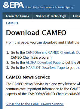
User clicks MARPLOT Download Page:
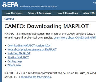
User clicks MARPLOT Fact Sheet:
User clicks CAMEOfm:
CAMEOfm
CAMEOfm (Computer-Aided Management of Emergency Operations) is a database application (with eight modules) designed to help first responders and emergency planners access and manage crucial chemical property and emergency response information for hazardous chemical releases.....
…ALOHA, MARPLOT, and CAMEO Chemicals can also be used independently of the CAMEOfm interface.
Accessing CAMEOfm
CAMEOfm is developed jointly by NOAA and the Environmental Protection Agency (EPA), and it runs on both Mac and Windows computers.
CAMEOfm Program: Download CAMEOfm from the EPA CAMEO site.
More Information about CAMEOfm
CAMEO Fact Sheet [PDF, 758 KB]: Learn more about basic features of the four core CAMEO suite programs in this CAMEO fact sheet.
CAMEO News Service: Join the CAMEO News Service e-mail list on the EPA CAMEO site to receive news and other helpful information from the development team.
CAMEO Companion [PDF, 13 MB]: Learn more about working with all of the CAMEO suite products with the CAMEO Companion, a written help resource...
CAMEO Software Suite: Find out more about the four core programs—and several related programs—in the CAMEO software suite,….
Questions: Contact us with questions, comments, or suggestions about CAMEO.
Task 2. Incident Meteorologist/National Weather Service needs background on how NOAA is generally involved in responding to oil spills.
Mobile Homepage:

User clicks New report: Oil Spills in Marshes
[add when this report is posted online]
User clicks Find Publications
Publications
NOAA's Office of Response and Restoration has prepared a number of job aids, reports, and publications to help people deal with spills of oil and petroleum products. Use the links below to learn more about these free resources.
ALOHA Example Scenarios
To build your knowledge of ALOHA and MARPLOT, download this training document...
Characteristics of Response Strategies: A Guide for Spill Response Planning in Marine Environments
This job aid is designed to help spill responders select appropriate response options…
Dispersant Application Observer Job Aid
This field guide serves as a refresher for people who have completed training in dispersant application observation....
Oil Types
Learn about the many different kinds of oil, which differ from each other in viscosity, volatility, and toxicity…...
Open Water Oil Identification Job Aid for Aerial Observation
This job aid contains aerial color photos of oil on water to assist in identification of thickness, structure, and estimated volumes of oil on the water.
Trajectory Analysis Handbook
This 2002 guide describes the basic concepts involved in analyzing the trajectory of spilled oil.
Characteristic Coastal Habitats: Choosing Spill Response Alternatives
This is a job aid designed for anyone who needs to decide if, where, when, and how to remove oil from coastal habitats.
User clicks Menu:

User clicks Training & Education:
Training and Education
NOAA's Office of Response and Restoration (OR&R) offers educational resources for teachers and students, as well as various workshops and self-study options to spill response professionals in local, state, and federal governments and industry.
The goal of this training is to transfer scientific expertise and experience to the broadest possible audience...
Training
Each year, OR&R provides extensive training to approximately a thousand individuals in industry and government on the scientific aspects of oil and chemical spill response...
Register now for our popular Science of Oil Spills class or build your knowledge of spill and chemical accident response on your own, using our job aids and publications.
Questions? Contact the Training Specialist.
Education: For Students and Teachers
Explore an ocean's-worth of information related to our efforts to protect and restore the nation's waters from pollution. You'll find experiments and activities for elementary school students and life-long learners alike....
User clicks Oil & Chemical Spills (in Main Menu):
Oil and Chemical Spills
Every year NOAA responds to more than a hundred oil and chemical spills in U.S. waters, which threaten life, property, and public natural resources….
Oil Spills
During an oil spill in coastal waters, OR&R's role is to provide scientific support to the U.S. Coast Guard….In addition to spill response software and mapping tools….
Chemical Spills
Chemicals can be an important part of manufacturing valuable economic goods—but they can also create dangerous situations…
Significant Incidents
For significant spills, OR&R is responsible for providing scientific support to the Federal On-Scene Coordinator...
Disaster Response Center
The NOAA Gulf of Mexico Disaster Response Center (DRC) is the newest addition…
User clicks Oil Spills
Oil Spills
During an oil spill in coastal waters, OR&R's role is to provide scientific support to the U.S. Coast Guard officers in charge of response operations. In addition to spill response software and mapping tools, OR&R provides standard techniques and publishes guidelines for observing oil, assessing shoreline impact, and evaluating accepted cleanup technologies...
Response Tools
To better prepare response communities for oil spills, OR&R develops several software and map tools for spill response and planning. These include GNOME, a trajectory forecasting tool; ADIOS, an oil weathering model; Environmental Sensitivity Index (ESI) maps, that identify vulnerable resources and habitats; and ERMA®, a GIS-based tool that consolidates key response data…
Resources
OR&R also publishes many of its guidelines for emergency responders and planners as small, field-oriented job aids. Find electronic versions of these job aids along with other oil spill response publications here, including Seafood Safety After an Oil Spill, the Shoreline Assessment Manual, and the FOSC's Guide to NOAA Scientific Support....
User clicks standard techniques and publishes guidelines OR Resources:
Resources
OR&R also publishes many of its guidelines for emergency responders and planners as small, field-oriented job aids...
Oil Spills in Marshes: Planning and Response Considerations
This 2013 report is intended to assist those who work in spill response and planning…
Shoreline Cleanup and Assessment Technique (SCAT)
SCAT is a systematic method for surveying an affected shoreline…
Shoreline Countermeasures Manuals
These manuals are customizable tools…
Dispersant Application Observer Job Aid
This field guide serves as a refresher for people who have completed training in dispersant application observation....
Trajectory Analysis Handbook
This 2002 guide describes the basic concepts involved in analyzing the trajectory of spilled oil.
Seafood Safety After an Oil Spill
When spill response managers determine that seafood may be affected by spilled oil…
User clicks Response Tools / Oil Spill Response & Planning:
Response Tools for Oil Spills
Here is a quick guide to many of the most commonly used tools and resources that OR&R offers…
Software and Datasets
ADIOS, NOAA's oil weathering model.
ERMA®, NOAA's interactive online mapping tool for environmental response data…
Environmental Sensitivity Index (ESI) maps and data, concise summaries of coastal resources that may be at risk in a spill incident.
GNOME, NOAA's oil spill trajectory model.
GOODS, a tool that helps GNOME users access base maps, ocean currents, and winds.
NUCOS, a simple desktop unit converter that includes units unique to oil spill response…..
Publications, Training, and other Resources….
More Information about Oil Spill Response…
User action steps to copy and paste:
User clicks Site Map
Site Themes
Tools, publications, and information related to our work…
Oil and Chemical Spills (246)
Oil Spills (160)
Response Tools (74)
Resources (70)
Chemical Spills (54)
Response Tools (19)
Resources (35)
Significant Incidents (25)
Exxon Valdez Oil Spill (21)
Disaster Response Center (2)
Environmental Restoration (16)
Environmental Assessment Tools (6)
Marine Debris (43)
Training and Education (32)
Training (16)
Workshops (5)
Self-Study Resources (11)
Education… (16)
About (295)
For Media (279)
Maps and Spatial Data
Tools, projects, and information related to mapping and spatial data, such as the online mapping tool, ERMA; the mapping program, MARPLOT; and the environmental sensitivity maps of the U.S. coastline, the ESIs.
Maps and Spatial Data (63)
Environmental Response Management Application (ERMA) (12)
Multimedia…
Publications…
User clicks Oil & Chemical Spills:
Oil and Chemical Spills
Every year NOAA responds to more than a hundred oil and chemical spills in U.S. waters, which threaten life, property, and public natural resources….
Oil Spills
During an oil spill in coastal waters, OR&R's role is to provide scientific support to the U.S. Coast Guard… In addition to spill response software and mapping tools….
Chemical Spills
Chemicals can be an important part of manufacturing valuable economic goods—but they can also create dangerous situations…
Significant Incidents
For significant spills, OR&R is responsible for providing scientific support to the Federal On-Scene Coordinator...
Disaster Response Center
The NOAA Gulf of Mexico Disaster Response Center (DRC) is the newest addition…
User clicks Oil Spills
Oil Spills
During an oil spill in coastal waters, OR&R's role is to provide scientific support to the U.S. Coast Guard officers in charge of response operations. In addition to spill response software and mapping tools, OR&R provides standard techniques and publishes guidelines for observing oil, assessing shoreline impact, and evaluating accepted cleanup technologies...
Response Tools
To better prepare response communities for oil spills, OR&R develops several software and map tools for spill response and planning. These include GNOME, a trajectory forecasting tool; ADIOS, an oil weathering model; Environmental Sensitivity Index (ESI) maps, that identify vulnerable resources and habitats; and ERMA®, a GIS-based tool that consolidates key response data…
Resources
OR&R also publishes many of its guidelines for emergency responders and planners as small, field-oriented job aids. Find electronic versions of these job aids along with other oil spill response publications here, including Seafood Safety After an Oil Spill, the Shoreline Assessment Manual, and the FOSC's Guide to NOAA Scientific Support....
User clicks Oil Spills / Response Tools
Response Tools for Oil Spills
Here is a quick guide to many of the most commonly used tools and resources that OR&R offers…
Software and Datasets
ADIOS, NOAA's oil weathering model.
ERMA®, NOAA's interactive online mapping tool for environmental response data…
Environmental Sensitivity Index (ESI) maps and data, concise summaries of coastal resources that may be at risk in a spill incident.
GNOME, NOAA's oil spill trajectory model.
GOODS, a tool that helps GNOME users access base maps, ocean currents, and winds.
NUCOS, a simple desktop unit converter that includes units unique to oil spill response…..
Publications, Training, and other Resources….
More Information about Oil Spill Response…
User clicks Oil Spills / Resources OR standard techniques and published guidelines OR job aids
Resources
OR&R also publishes many of its guidelines for emergency responders and planners as small, field-oriented job aids...
Oil Spills in Marshes: Planning and Response Considerations
This 2013 report is intended to assist those who work in spill response and planning…
Shoreline Cleanup and Assessment Technique (SCAT)
SCAT is a systematic method for surveying an affected shoreline…
Shoreline Countermeasures Manuals
These manuals are customizable tools…
Dispersant Application Observer Job Aid
This field guide serves as a refresher for people who have completed training in dispersant application observation....
Trajectory Analysis Handbook
This 2002 guide describes the basic concepts involved in analyzing the trajectory of spilled oil.
Seafood Safety After an Oil Spill
When spill response managers determine that seafood may be affected by spilled oil…
User clicks Oil Spills / Response Tools
Response Tools for Oil Spills
Here is a quick guide to many of the most commonly used tools and resources that OR&R offers…
Software and Datasets
ADIOS, NOAA's oil weathering model.
ERMA®, NOAA's interactive online mapping tool for environmental response data…
Environmental Sensitivity Index (ESI) maps and data, concise summaries of coastal resources that may be at risk in a spill incident.
GNOME, NOAA's oil spill trajectory model.
GOODS, a tool that helps GNOME users access base maps, ocean currents, and winds.
NUCOS, a simple desktop unit converter that includes units unique to oil spill response…..
Publications, Training, and other Resources….
More Information about Oil Spill Response…
User clicks Training and Education
Training and Education
NOAA's Office of Response and Restoration (OR&R) offers educational resources for teachers and students, as well as various workshops and self-study options to spill response professionals...
The goal of this training is to transfer scientific expertise and experience to the broadest possible audience...
Training
Each year, OR&R provides extensive training to approximately a thousand individuals in industry and government on the scientific aspects of oil and chemical spill response....
Register now for our popular Science of Oil Spills class or build your knowledge of spill and chemical accident response on your own, using our job aids and publications.
Questions? Contact the Training Specialist.
Education: For Students and Teachers
Explore an ocean's-worth of information related to our efforts to protect and restore the nation's waters from pollution. You'll find experiments and activities...
User clicks Job Aids & Publications, or Find Publications
Publications
NOAA's Office of Response and Restoration has prepared a number of job aids, reports, and publications to help people deal with spills of oil and petroleum products. Use the links below to learn more about these free resources.
ALOHA Example Scenarios
To build your knowledge of ALOHA and MARPLOT, download this training document...
Characteristics of Response Strategies: A Guide for Spill Response Planning in Marine Environments
This job aid is designed to help spill responders select appropriate response options…
Dispersant Application Observer Job Aid
This field guide serves as a refresher for people who have completed training in dispersant application observation....
Oil Types
Learn about the many different kinds of oil, which differ from each other in viscosity, volatility, and toxicity…...
Open Water Oil Identification Job Aid for Aerial Observation
This job aid contains aerial color photos of oil on water to assist in identification of thickness, structure, and estimated volumes of oil on the water.
Trajectory Analysis Handbook
This 2002 guide describes the basic concepts involved in analyzing the trajectory of spilled oil.
Characteristic Coastal Habitats: Choosing Spill Response Alternatives
This is a job aid designed for anyone who needs to decide if, where, when, and how to remove oil from coastal habitats.
User clicks Oil & Chemical Spills (in Main Menu):
Oil and Chemical Spills
Every year NOAA responds to more than a hundred oil and chemical spills in U.S. waters, which threaten life, property, and public natural resources….
Oil Spills
During an oil spill in coastal waters, OR&R's role is to provide scientific support to the U.S. Coast Guard….In addition to spill response software and mapping tools….
Chemical Spills
Chemicals can be an important part of manufacturing valuable economic goods—but they can also create dangerous situations…
Significant Incidents
For significant spills, OR&R is responsible for providing scientific support to the Federal On-Scene Coordinator...
Disaster Response Center
The NOAA Gulf of Mexico Disaster Response Center (DRC) is the newest addition…
User clicks Chemical Spills:
Chemical Spills
Chemicals can be an important part of manufacturing valuable economic goods—but they can also create dangerous situations if accidentally released. OR&R develops several free tools, such as the CAMEO software suite, to help emergency responders and planners assess hazardous material releases and protect public health and safety.
Response Tools
Some of OR&R's more widely distributed chemical spill response tools include the CAMEO software suite (CAMEOfm, CAMEO Chemicals, ALOHA, and MARPLOT), a group of programs used by first responders and planners to help them prepare for and deal with hazmat emergencies. In addition, responders and planners can use the Chemical Reactivity Worksheet, a program that allows you to see what reactions might occur when pairs of chemicals are mixed together.
Resources
Emergency responders (as well as programmers developing tools for use with the CAMEO software suite) can find an assortment of helpful guides, software tools, and training information …
User clicks CAMEO Software Suite:
CAMEO Software Suite
The CAMEO (Computer-Aided Management of Emergency Operations) software products have been valuable hazardous materials response and planning tools since the first products were introduced in 1986....
CAMEO Software Suite: Core Programs
CAMEOfm: A database application ….to assist with data management requirements under the Emergency Planning and Community Right-to-Know Act (EPCRA)....
CAMEO Chemicals: A program that allows you to search for chemicals in the CAMEO chemical database, print customized reports with response recommendations, and find out how chemicals would react if they mixed….
ALOHA: A modeling application that estimates threat zones associated with hazardous chemical releases, including toxic gas clouds, fires, and explosions.
MARPLOT:
A mapping program with which you can easily view and modify maps, and
you can also create your own objects.
CAMEO Software Suite: Related Software
The Chemical Reactivity Worksheet: A program that allows you to see what reactions might occur when pairs of chemicals are mixed together...
Tier2 Submit: A program that generates an electronic chemical inventory Tier II facility report, which can be used to automatically update the facility information in CAMEOfm...
User clicks MARPLOT:
MARPLOT
MARPLOT is a mapping program. With MARPLOT's easy-to-use GIS interface, you can quickly view and modify maps, and you can create your own objects to place on the maps…
You can also customize your view by drawing your own objects on the map…
As part of the CAMEO software suite, MARPLOT can be used with other programs in the suite: responders can link overlay objects to the CAMEOfm database program and easily display ALOHA threat zones….
Accessing MARPLOT
MARPLOT is developed jointly by NOAA and the Environmental Protection Agency (EPA)…
MARPLOT Program: Download MARPLOT from the EPA CAMEO site.
MARPLOT
and Environmental Sensitivity Index (ESI) Maps
You can also use MARPLOT to display ESI maps…
More Information about MARPLOT
MARPLOT Fact Sheet [PDF, 948 KB]: Learn more about basic features of MARPLOT...
MARPLOT Technical Documentation: Download a document (from the EPA CAMEO site) that describes the technical details of the program...
| File Type | application/msword |
| Author | NOSTEMP |
| File Modified | 2014-07-02 |
| File Created | 2014-07-02 |
© 2026 OMB.report | Privacy Policy